Thursday, December 31, 2015

Grays Peak hike, Colorado, USA - August 2015

Ever since I moved to Colorado last year, I’d planned to climb as many fourteeners [a mountain that has an elevation of 14,000 feet or more] as possible. After all, this state does have 58 of them! After a year of slogging through the first year of my PhD program at CU-Boulder and spending the summer in Kathmandu, Nepal - I returned to Boulder with a renewed resolve to at least climb one fourteener before I went back to the grind of my PhD. Thankfully, the mountain gods were smiling down at me … even if it was one year after having lived in Colorado. Well, events happen - when they are supposed to happen I guess, irrespective of how much you try to make them happen OR events happen - when your fellow hikers/friends are all available and willing to climb up a fourteener on the exact same day that you have chosen! SO on the auspicious day of August 22nd, 2015 - I finally set out to climb my very first fourteener with a group of four other friends. We chose to climb -  Grays peak: the ninth highest peak in Colorado at 14,270 ft/ 4350 m. Now, the reason we chose this particular peak was because it is highly regarded as one of the easiest fourteeners in CO. However, I should also point out that I have often been told the following as well - “There is no such thing as an easy fourteener!”

Be these assumptions - true or false - what I can say is that our motley group of 5 consisted of #1) who had done multiple fourteeners but was recovering from an injury, #2) who had done only one fourteener and that being the highest fourteener in the contiguous United States, #3) who had done no fourteeners but who otherwise worked out regularly and was physically well-equipped to deal with this beast, #4) had done no fourteener and not many hikes and managed (in my opinion) to tackle this fourteener due to her sheer grit and determination, #5) [ME!!!] who had always dreamt of doing ALL the fourteeners [at least in CO) and was reasonably (not so much in retrospect] fit but was also recovering from an injury. With a few hiccups notwithstanding, ALL FIVE of us did manage to successfully go up and reach a lofty height of 14,270 ft. and come down back to a measly 11,230 ft -the starting point of our hike at the  Stephen Gulch Trailhead. So, what follows is a [hopefully] brief account of my first ever fourteener …    

Now the BIGGEST problem for me about climbing a Colorado fourteener is that you have to be at the trailhead at the crack of dawn or may be even hours earlier so that you can be up at the peak and down again before the thunderstorms set in during the afternoon. Now, I don’t want to go into the science behind why these thunderstorms need to occur in the afternoon in Colorado, [this is not true for the California fourteeners as far as I know] but what I do know is that there have been cases of people getting struck by lighting up at these peaks. So, as thoroughly annoying as it may be to drag ourselves out of bed in the middle of the night, I’d rather lose a few hours of sleep than several hours of my life. So, given our love for our mortal coil, we dutifully gathered around 4.30 am in the dark at our apartment parking lot in Boulder - dressed in warm clothing which turned out to be not warm enough in retrospect. Now, this was August - relatively warm here in Boulder. I figured it will be a bit cold up there at over 14000 ft so I packed some extra layers but what I didn’t figure was that my tropical climate-loving body would not be able to withstand the windy weather which brought the temperature much further down. So, note to self: for your next fourteener - pack layers as if you are heading to subzero temperatures irrespective of whether you are going there in summer!

Our drive to the Stephen Gulch trailhead took an hour or so [can’t recall exactly since I am writing this post 4 months later :P] But I do remember there are two parking lots… low clearance vehicles park 2-3 miles out and hike up to the main trailhead whose access is limited to high clearance vehicles. Even though we got there fairly early [around 5.30 am], the parking lot was full and we had to park along the road. With that began the hike to my first fourteener. The initial climb was pretty decent - not too steep - and given that the parking lot was overflowing and vehicles were parked along the road - you can guess there was heavy traffic on the trail. Believe it or not - I was reminded of the yatras back in India - the holy pilgrimages that scores of Indians undertake to the holy peaks in the Himalayas. The difference being that most of the hikers on this trail were equipped in gear worth more $$$ than most of those holy pilgrims in India encounter in their entire lives. Money matters apart - the hike was relatively pleasant. Although the trail was overcrowded, fellow hikers were polite and did not complain when they were slowed down by others. The slower ones often graciously let the others pass. Trail/hiking/outdoor etiquettes are a new kind of behavior that I have encountered in this country [..took my ill-mannered self quite a while to get the hang of it…] and one that I hope people emulate all over. Indian mountains would be much happier if fellow travelers packed in their trash and followed the “Leave no trace” code of behavior followed here.
 
Whatever be our ethical obligations, I just wish there was an easier way to pee in that crowded area. Since we were above the tree line -no vegetation such as bushes or trees, there was not much cover to answer nature’s call in much privacy. The only way to get privacy was to bush whack far away from the trail and crouch behind an elusive rock and bare your behind to the vicious winds. Well, as one woman whom I encountered [to my bad luck] - peeing on the streets in downtown Reno - once told me “When you have to go, you have to go!” So that is what we did... 

About halfway up, the climb got pretty steep and I was gulping in air that was frigid cold and probably lacking in much needed oxygen. I also realized how out-of-shape I was. Nonetheless, we trudged on. Couple of our group members picked up speed and got ahead of us while another one decided to take it much slower. I hiked at my own speed to make sure I didn’t over exert just to keep up with the group. Ultimately, as I have come to realize - following a pace that you are comfortable with helps you keep up for a much longer duration. And this realization has served me well on many an occasion. 

It’s roughly a 4 mile trip (probably a bit less ...like 3.8) up to the summit from the trailhead depending upon how many detours you need to take to pee in peace. Given how dry this beautiful state is, you NEED too gulp water by the gallons and what goes in needs come out sooner or later…and in cold weather it is usually sooner than later :P … So the four hour hike uphill took me about four hours (that was how out of shape I was … and still am…) It was four of us who made it there at roughly the same time (give or take 15 minutes…) The feeling that I had when I stood on top of that peak can be described in one word - CHILLY! - Oh, how I wish I had more layers to give me some much needed warmth. After a few  pics and gazing lovingly at the Rockies around us, we began our descent. The two in our group who had reached earlier again picked up their pace and left us far behind. I as usual hiked at my own pace. At the same time, I happily provided words of encouragement (as humbly as possible) to those who were still headed uphill.

On the hike down, we encountered the last of our group members still determinedly headed uphill… She was having a tough time but she was ready to battle it out. The only thing I was worried about was that it was approaching noon - which meant the thunderstorms may not be far away. But it seemed like she could make it in time so we told her we’d wait for her further down the path where the wind was not freezing us up. On a nice flat area about a couple of miles down the trail, we decided to take a short nap while we waited for our friend to come back. That was a wonderful nap… filled with the satisfaction of having climbed my first fourteener. After about an hour of napping, the first hailstones hit us. Phattu that I am - I was already imagining thundering showers and lighting. By this time, the crowd had considerably thinned and there didn’t seem to be a lot of people on the trail. We hoped our friend had made it back in time since both of us had dozed off… and she probably didn’t notice us snoozing away… 

We hiked back but the hailstones seemed to be a false alarm. Nothing much happened... at least not at our elevation. Also, I realized my leg has not yet healed up completely. So I took it slow. We made it back to the trailhead by 2 pm including the couple of hours of napping, munching breakfast, peeing, etc... on the trail. It took the fifth member of our group another hour or so to get back. Thankfully, she didn’t encounter any thunderstorms!… just a bit of rain but no lightning… Apparently she got to celebrate her summit with fellow Indians who had a packed lunch of Indian delicacies with them that they were enjoying on the summit!

There wasn’t much wildlife up there.... may be pikas(?) and quite a bit of wildflowers looking splendid as always. 

And so with that concludes the account of my very first fourteener in a country far far away from home (yeah.. I just watched Star Wars…). Hopefully when I return to the Himalaya, I’d aspire to reach heights much higher than these :P


Tuesday, July 28, 2015

ICIMOD Knowledge Park @ Godavari, Kathmandu, Nepal - July 2015

This Sunday I got a chance to finally visit ICIMOD’s Knowledge Park @ Godavari. Being exhausted and a little sore from the long hike to Sundarijal the day before, I was looking forward to a leisurely stroll in the knowledge park in Godavari. And the friend who accompanied us was well-versed with a lot of the flora in the area and in general about the biodiversity of the region - so that was an added bonus. 

We first caught a taxi to Satdobato (and for the first time in two months, the driver actually charged by the meter!… getting a hang of this place, I’d say!) Then we caught a micro to Godavari which was the last stop. After a good breakfast, where I was taught the art of flawlessly peeling boiled eggs, we set out towards the knowledge park.

The gate seemed locked but in reality wasn’t!!! After working out the lock meant to fool the novice, we headed in to the beautifully maintained park.
The main entry way
The main office
 The map of the area
                       The cicada camouflaged on the bark                                
Giant earthworms
                              Cicada exoskeleton                
 Some sort of solar heating equipment
 Loads of mushrooms around there
 Bricks and cook stoves
 There were a whole lot of slippery mossy stairs... 
 Beautiful flowers out there!
 Beautiful flowers with nectar for butterflies...
We also ran into a naturalist, Karen Conniff, who has published some handy guides on:

We took a long break from an overlook where we could view the snow clad mountains far away in the distance. It was an almost clear day so we got some very good views with a layer of smog just below. 
We ventured a little bit into the thick canopied forest always on the lookout for leeches, which we did encounter!

The cicadas were everywhere but there were also some birds… beautiful and serene even in the midst of the cacophony… the thick canopy was beautiful.

Thanks to a dear dear friend, I got to check this off my list of places to visit before the end of my first trip to Nepal!   

Monday, July 27, 2015

Budhanilkantha to Sundarijal, Shivapuri Nagarjun National Park, Nepal - July 2015

On my last weekend in Nepal (for this trip …), we set out on the longest hike yet! It felt like a fitting farewell (part 1) to a region I have called home for the past two months… And my two housemates joined in for the first time :) One of our colleagues had done this hike before and without him this would not have been possible ...  He set a good pace that got us through in good time.

A total of around 20 kms (approx. 12 miles) starting from one of the entrances of Shivapuri Nagarjun National Park located at Budhanilkantha. This national park is located north of Kathmandu valley and is probably the closest one from the valley. This being a much longer hike, we decided to start earlier than usual. We left  Ratnapark (old bus park) around 7.15 am and got to our starting point in about 30 minutes in a micro. (Although extremely uncomfortable at times, I prefer using local transportation. It makes you feel like you belong…) But before we got to the starting point of our hike, we visited the temple of Budhanilkantha which houses the statue of the sleeping god Vishnu. 
Then after a very spicy breakfast of samosa tarkari from a roadside restaurant, we set out toward the entrance of Shivapuri Nagarjun National Park around 9 am. It’s a bit of a climb to get to the entrance but it’s a tar road with beautiful views.

There’s an entry fee which varies depending upon your country of origin and what exactly
you plan to do at the park! There's even a fee for helicopter landings!!!

The entrance... 
They seemed to be pretty strict about the entry ticket. There was an army outpost behind the gate where the army officer checked out our tickets and noted our names and countries in his ledger. A couple of foreigners tried to sneak past them but were sent back. I am not sure why they were attempting to avoid a $5 entry fee which is probably peanuts for them. Anyway, our tickets were also checked at our exit point!

Here’s the checklist of its flora and fauna.
The hike was long but not strenuous. The only major elevation gain was when we went up to Nagi Gumba - a local nunnery that seemed to have suffered quite a bit of damage from the quake. The nuns were rebuilding the place when we visited. It was my first Buddhist nunnery and quite a unique experience. 

There’s a small shop where you can buy snacks. We consumed quite a bit of those I’d say :P

We were told the whole area would be infested with leeches. Luckily for us, we were misinformed about the infestation. Along the trail there wasn’t a single leech. We did encounter a few (but more on that later…)

There were cicadas around creating a ruckus. It was so loud that there were moments when I had to close my ears! Apparently, the sound of cicadas is loud enough that it can cause hearing loss in humans if it sings right outside the human ear!!! They can also pierce your skin looking for nectar, if they happen to perch on you and mistake your limb for a tree trunk filled with sap!!! But otherwise these fellows are harmless :P We spotted a few dead ones on the way. 

Other things we encountered...

Indian moon moth (actias selene) - a broken wing 

Himalayan keelback (???) (… If someone can ID correctly, let me know…)

Some other creatures and other things that we came across… 


They need to get a room...

On and on we went, covering kilometer after kilometer at a steady pace. It’s a very dense forest. The day was humid and although it didn’t rain for the better part of our hike, we were already drenched in sweat!

Along the way, we rested, snacked, and drank loads of water since we were sweating buckets!  Since the major landmark, Dharahara, collapsed during the earthquake, our local colleagues were at a loss regarding the location of the other minor landmarks…  A cruel reminder of the recent devastation. Hope it’s built back up soon!

We got some beautiful views of the valley. 

Since it was a Saturday, we encountered quite a few youngsters enjoying the hike. But we tried to steer clear of them as much as we could since they were too loud for us! None of them seemed to be in any sort of hiking gear - not even shoes. People were in flip flops on that uneven terrain. I have found this to be the case even when hiking in India and have always been amazed by the experience. I would have sore feet for sure if I did that. But I guess they are accustomed to it… being from a  mountainous region… Or does it have to do with the poverty in the region? … I don’t know… 

We took a few shortcuts to reduce the very long distance that we had to cover… Some shortcuts were more interesting than others!

After about 2/3rds of the hike, we crossed a bridge under which flowed a strong stream which would probably join the Bagmati river. Apparently, this catchment area provides a a lot of the drinking water to the valley. We were unsure about whether we could wade into the water since this was the source of the drinking water supply. But the water was too tempting and there weren't any overt signs prohibiting entering the river. So we waded into the ice cold water and got some good pictures while we were out having fun while freezing our feet… 

We resumed our hike, only to realize that we would have to once again cross the river because our path was blocked. But our path was on the same bank, so we had to cross and then come back across to join our original path… And this is where the most interesting part of the hike occurred. As we shed our shoes on the shore, we noticed leeches jumping!!!

Not having encountered any on the way, I was taken by surprise! We quickly tried to cross but the current was too strong for us. Ultimately, we formed a chain and crossed while leeches tried to cling on to our legs. A lot of locals were swimming in the river oblivious to the leeches around them…

I was so overwhelmed by the surprise attack that I did not take any photos :( Thankfully, we had salt with us and got rid of the leeches quickly. Not before some of us got bit though… 

Back on our original path, we walked just a bit ahead to get to the dam. It was streaming with locals having fun in the cold water. That’s when the first drops of rain began. The heavy downpour was yet a few hours away….
The dam... 

We then had to climb up slippery steps that were very risky. How people were doing them in regular footwear without much grip is beyond me… I even managed to slip once and get a nice bruise on my hip :(

This seemed to be a tourist site because it was filled with people and garbage. The garbage is conspicuous all throughout my travels in this country. On this particular hike, I encountered anything from food wrappers, to discarded condom wrappers, to used sanitary napkins. I wish I wasn’t so squeamish because I remember wanting to rush through this area since it made me want to puke… Having the ability to observe things that others often miss can be a boon and a curse...

The Sundarijal waterfall (devoid of the people and garbage) was beautiful… 


After getting our tickets checked at the gate again, we bid goodbye to Shivapuri Nagarjun National Park and then descended another long flight of very slippery stairs. Here is when the rains began to gather a bit of momentum. We halted once to get some refreshments. Hiking in the Indian subcontinent, does have its perks… a hot cup of tea is never far away… 

Damage from the earthquake… the water pipe shifted…  

At the bottom of the stairs, we caught a bus to Ratnapark, the old bus park. By then the gray clouds were turning black...

We caught a micro bus to Jwalakhel circle which was so stuffy! The windows were shut since it was raining like hell and we were squished like sardines in there (...borrowing a colleague’s oft-repeated phrase). When we got down, the road was submerged in at least a foot of water. But I don’t regret not taking a taxi home… this was an experience to remember!

Muddy, dirty, and exhausted to the core we made it home by 7 pm! We had hiked for almost 7 to 8 hours that day and walked for almost 20-21 kms! I loved (almost) every moment of it :)  

Wednesday, July 22, 2015

Lazing around in Pokhara, Nepal - July 2015

For a long weekend getaway near Kathmandu, friends and colleagues suggested that Pokhara is THE place to go. So, with my parents visiting Nepal for just 5 days, I decided to take them to Pokhara, located 200 kms to the west of Kathmandu. It’s an approximately 7 hour drive by road with many tourist buses available. Being short on time and road conditions being subject to unpredictable weather, we decided to take the short 25 minute flight from Kathmandu to Pokhara that cost approximately 7000/- in local currency for SAARC residents for the round trip. Apparently, it costs more than double for non-SAARC residents! The domestic airport in Kathmandu is tiny. The one in Pokhara is even tinier! The exit where the baggage claim was located is a single room with chairs and a small counter to collect your luggage. We took Yeti Airlines from Kathmandu to Pokhara. It was a tiny plane - Jetstream 41 - with a two-one seating arrangement. We had turbulence for a very short while but it was a scary moment to be flipping in a tiny plane! The return flight was of Buddha Air. It was slightly bigger with a two-two seating arrangement and no flips due to turbulence.  

There are quite a lot of places to explore in Pokhara. It is most well known for Phewa lake and the spectacular views of the Annapurna range of the Himalaya.  This being the monsoons, the weather was mostly cloudy but we managed to get quite a few glimpses of the mountains.
 
Lakeside: The Lakeside is where most of the hotels are located and is also lined with tourist shops selling an assortment of locally produced goods including yak wool blankets, pashminas, knitted gloves, hats and a wide range of souvenirs.

Phewa lake and Barahi temple: One of the main attractions of Pokhara. The hotels and shops run all along the lake on one side. On the other side is a huge hill atop which sits the World Peace Pagoda. We took an hour long boat ride around sunset on the lake. Since this is the off season, there were very few tourists and we got to enjoy a serene boat ride. The lake was muddy owing to the heavy rains bringing in mud from the hillside and was also infested with Hyacinth. The boat guy informed us that the community often rallies together and organizes hyacinth removal days. Recently they had pulled out quite a few tonnes of hyacinth.   

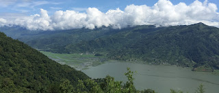
View of the lake

Hyacinth in the lake

Colorful boats at the lake

We even got a glimpse of Machhapuchhre (Fishtail) peak from the lake!
To the right side is a small peak way at the back... that's Machhapuchhre


Sarangkot provides views of Annapurna range and Machhapuchhre (Fishtail). Early morning at day break we left for Sarangkot located on the eastern side away from Lakeside, Pokhara. From that vanatage point, on clear days you can view the entire Annapurna range. Unfortunately, the day we visited it was not a clear day. We did manage a few glimpses of Annapurna and Machhapuchhre. And got some good chiya (the local Nepali word for tea).

Views of the Annapurna range


Bindhyabasini temple: While descending the mountain we stopped by at Bindhyabasini temple. There’s a steep staircase to climb. And there are a whole lot of worshippers up there!

I managed to snag pictures of a few deserted spots though :P


International Mountain Museum: Later after lunch, we went to the International Mountain Museum. This is a storehouse of knowledge when it comes to mountains. Very fascinating!
  
They have a yeti there!

We also went to Devi’s/Davis Fall where a woman with the last name Davis fell into the Falls… I have no clue why that story makes it a tourist attraction. The Falls disappear into the rocks. On the other side are the Gupteshwor Mahadev caves. I bought tickets to go see the caves but then got too scared to actually venture in… It was really claustrophobic in there!

The Falls

The staircase leading down to the caves...

Early morning the next day while waiting for the car at the hotel, we could glimpse the mountains from the valley itself. The clouds had cleared for a few minutes! I raced up to the terrace to get a good view!


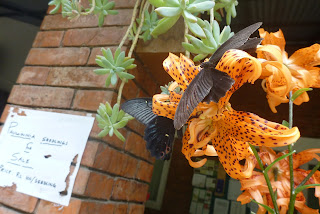
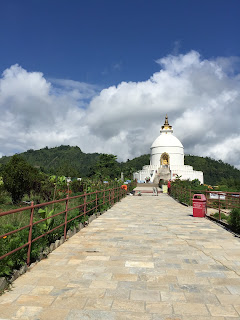
Shanti Stupa/World Peace Pagoda: Then we drove to the World Peace Pagoda on the opposite bank of Phewa lake. The car only takes you up to a certain point up the hill and then you need to walk a long flight of stairs. The road was really bad with a lot of potholes that had become worse with the monsoons. Although we were in a 4WD (Mahindra Scorpio) I was amazed to see smaller cars making the journey up. After the 15-20 minute climb up the stairs, you reach a wide open space filled with flowers. It’s beautifully maintained and has quite a few butterflies! I think this was probably the first time I saw so many different varieties of butterflies in the region. 


The Pagoda lies at the top of another steep flight of stairs and you need to take off your footwear. The ground can get really warm at this time of the year but it was manageable. 


You also get some beautiful mountain and lake views from here.

It was sooo hot that even the dogs needed shady patches!

Begnas Tal: After lunch, we drove to another lake located to the far east of Pokhara. It’s much smaller. But the lake view is beautiful!

And that day the local residents were clearing out hyacinth from the lake. There was so much hyacinth!

It was scorching hot and humid that day so we headed back soon. But not before my Dad feasted on some locally caught fish!

Old Pokhara bazaar: On our way back we went to the main city area. If you have spent time only in Lakeside in Pokhara, then this a must see. This is the heart of the city and it is like any other crowded city in the region :P

Lakeside shopping: Before you go, do not forget to shop to your heart’s content. This being the off season, there weren’t a lot of shoppers. Even the shop keepers were disinterested!  

I don’t think I am a big fan of tourist towns. These places are geared for tourists. Day in and day out the locals encounter wide-eyed city-folks going crazy around them. I wonder if the locals have the means to visit/holiday in tourist places themselves. I felt self-conscious as a tourist. And a part of me felt sad being there…